
The application of Unmanned Aerial Vehicle For creating 3D model database in Architecture Case study : Building 3 and Building 22, Architecture Program Rajamangala University of Technology Isan Nakhon Ratchasima
Article Sidebar
Main Article Content
Abstract
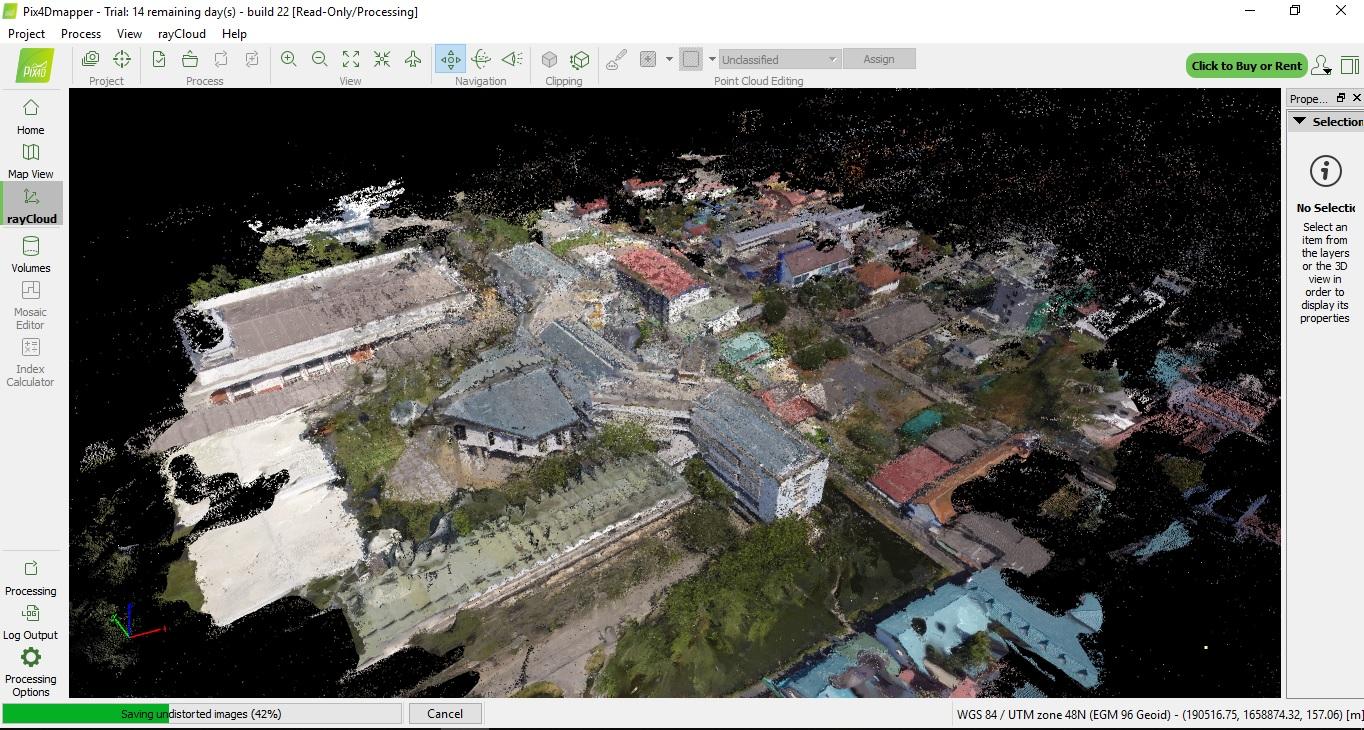
This article presents procedures and methods for collecting current conditions of buildings with Unmanned Aerial Vehicles (UAV) using Building 22 and Building 3 in the Architecture Program, Rajamangala University of Technology Isan, Nakhon Ratchasima as the case study location to store 3D model databases leading to the planning of the physical development of the building with free flight planning together with planning the way point flight in Litchi application. The results of the study showed that the total number of images taken was 256, with the total flight time of 15 minutes. The density of the point cloud was at the best level from images taken. The minimum matching image per 3D point were 3 images. The average density of 3D points per cubic meter was 483.96 points out of the total number of 3D points of 10,899,260 points, which were acceptable values. The study results suggest that point cloud data can be used to work with a variety of 3D programs such as Auto Cad, Autodesk Recap, or Autodesk Revit, to plan, build, and design guidelines for building improvements in various parts, such as to provide a more precise calculation of the area of the building frame or the design of facade, or use for building surveyors in areas where humans cannot access, etc. In addition, the study also found that the details of the photos of some buildings, especially in areas with a lot of trees, are not as complete as it should have been. The study, therefore, suggests that ground photographs should be taken in areas that the aircraft cannot access and can be combined with aerial photography to obtain more complete data.
Article Details

This work is licensed under a Creative Commons Attribution-NonCommercial-NoDerivatives 4.0 International License.
References
จิรศักดิ์ มากกลาง, “การอนุรักษ์ผังบริเวณและอาคารยุคโมเดิร์น : มหาวิทยาลัยเทคโนโลยีราชมงคลอีสาน”, ในการประชุมวิชาการระดับชาติ “วลัยลักษณ์วิจัย” ครั้งที่ 10, 2561, หน้า 1-7.
จเร วิฒทยากร และคณะฯ, “วารสาร วิทยาลัยเทคนิคภาคตะวันออกเฉียงเหนือ 2511”, นครราชสีมา, โรงพิมพ์เลิศศิลป์, 2511.
ธราวุฒิ บัญเหลือ, “การประยุกต์ใช้เครื่องบินบังคับอัตโนมัติเพื่อสร้างฐานข้อมูลแบบจำลองสารสนเทศอาคารสำหรับงานสถาปัตยกรรมผังเมือง กรณีศึกษา อ.ธาตุพนม จ.นครพนม”, วารสารวิชาการ คณะสถาปัตยกรรมศาสตร์ สจล, 2561, หน้า 137-148.
ประสิทธิ์ โตโพธิ์กลาง และคณะฯ, “วารสาร 30 ปี แห่งการสถาปนา วิทยาลัยเทคโนโลยีและอาชีวศึกษา วิทยาเขต เทคนิคภาคตะวันออกเฉียงเหนือ”, บริษัท ลิฟวิ่ง 4242667, 2529.
ไพฑูรย์ เวศสุวรรณ์ และคณะฯ, “วารสาร 4 ทศวรรษ สถาบันเทคโนโลยีราชมงคล ภาคตะวันออกเฉียงเหนือ นครราชสีมา”, อมรินทร์พริ๊นติ้ง แอนด์ พับลิชชิ่ง, 2539.
อภินันท์ สีม่วงงาม, “เทคนิคการใช้ sUAV ในการเก็บข้อมูลเพื่อการวางแผนและผังพัฒนาพื้นที่ กรณีศึกษา ถนนจอมพล จังหวัดนครราชสีมา”, วารสาร มทร.อีสาน, 2560, หน้า 25 – 39.
